Haven't been skiing, because I've been flying for work. So here are some aerial pics of the last 10 miles flying into Juneau.
Showing posts with label skiing. Show all posts
Tuesday, December 13, 2016
Sunday, December 11, 2016
12-11-16 Beta Pics
Working too much to ski. These are beta pics for later........
All taken from Eagle Beach (and a few from Auke Bay) area, looking up at the peaks above the Herbert and Eagle Glaciers.
![]() |
Mt Wrather above the Mendenhall Glacier |
![]() |
McGinnis Mtn above the Mendenhall Glacier, across from Mt. Wrather |
![]() |
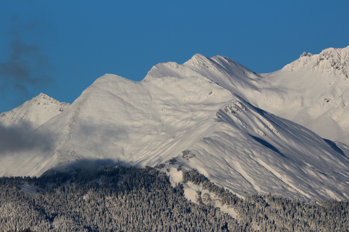
SE Face of Bullard with a sneaky couloir up the center of the face. This empties into Middle Basin of Nugget Creek. |
![]() |
Unnamed peak across the Herbert Glacier and SE of Earnest Gruening mountain. 3,000+ foot lines. Two miles of glacier travel to get to, plus four mile, mostly flat trail up Herbert Glacier trail |
![]() |
Same as above. |
![]() |
Huge west flank of Earnest Gruening. Empties into Eagle Glacier Cabin. |
![]() |
Same as above. Part of the flank of Earnest Gruening. |
![]() |
Steep south ridge of Earnest Gruening. The saddle is accessible via a south facing approach off the toe of the Herbert Glacier. |
![]() |
Looming west face of the West Tower of the Mendenhall towers. I think this is skiable. It's been climbed. 3,000+ foot line. |
![]() |
Approach up Earnest Gruening It's the tree/sunlit ramp lookers left, at the toe of the Herbert Glacier. 2,200ft approach to the ridgeline/saddle. |
![]() |
Large flank of Earnest Gruening down into the Eagle Glacier cabin. |
![]() |
Earnest Gruening flank again. |
![]() |
View from Eagle Beach and Eagle River of Earnest Grueing peak on left, Herbert Glacier lower right,and unnamed peaks in the background above the Herbert Glacier. |
Monday, December 5, 2016
12-5-16 Pk2970 again
Wanted to try to get some sunrise shots of Stephens Passage. Success, but super cold in doing so.
![]() |
Looking south of Douglas into Stephens Passage. |
![]() |
Oliver Inlet area. |
![]() |
Chilkats |
![]() |
Chilkats |
![]() |
NW of Stroller White Mtn |
![]() |
Not sure. |
![]() |
Chilkats |
![]() |
Western Mendenhall Towers. |
![]() |
Easter Mendenhall Towers |
![]() |
Mendenhall Towers in background, Mt Wrather in foreground. |
![]() |
Nugget Mtn over the Ptarmigan and Lemon Creek Glaciers. |
![]() |
Bullard Mtn |
![]() |
Split Thumb |
![]() |
Split Thumb |
![]() |
Not sure. |
![]() |
Looking north from Pk 2970 (Basically the top of Eaglecrest Ski area) Mt McGinnis in the distance/center/top. |
![]() |
Peaks above Cropley Lake at Eaglecrest ski area. Good, easy access. |
![]() |
Peak 3415 above Cropley Lake at Eaglecrest ski area. |
![]() |
Mt Troy in foreground, Mt Olds in background. |
![]() |
Observation Peak, I think? The one in the distance, right of center. Then the Mt. Juneau ridgeline center photo, in alpenglow. Mt Juneau is right above downtown. |
![]() |
Mt Golub area of Chilkats |
![]() |
Mt McGinnis center, and un-named gnar behind to the north. |
Subscribe to:
Posts (Atom)