Showing posts with label Sheep Creek. Show all posts

Friday, February 24, 2017

2-24-17 Hawthorne Peak

Walked up Sheep Creek trail to about 700ft elevation and hit snow, then walked in shoes to end of trail at about mile 3.  From there we booted up through the trees to treeline, then skinned a long up an left to the Hawthorne Peak ridgeline.  Booted to the summit, then backed off from skiing from the top due to wind loaded, steep terrain with ice underlying the windloaded pockets.   Ended up skiing way down into the couloir to the base of the mountain, then it got too steep and icy, and we booted about 1000+ ft back up and skied out the way we came in.  This peak currently needs more snow or warmer temps to ski it safely, it's just too icy.

Traversing to Hathorne with Sheep Mtn in the background

You could ski up over Poleline, then descend to that creek and go out to Taku Inlet.


Steep skiable couloir on Mt Roberts with the Chilkats in the background.

Michaels Sword is the spire, then Devils Paw massif to right.

Summit of Hawthorne back there.

Mt Roberts is peak above water, then left to right it's Sheep Mtn, then Poleline ridge.

Devils Paw

Dylan over Stephens Passage

Endless mountains, zero people.

Little steep section before the summit.

Taku Inlet background on right

Some great south facing couloirs above Stephens Passage

Summit block of Hawthorne

Split Thumb

Taku Towers?

Devils Paw couloir


Lunch on the summit

Pondering the ice


This "snow" is so loud it almost makes you deaf

Big couloir off the summit in the shade, couldn't ski it today, too icy.


Sunday, February 19, 2017

2-17-17 Mt Jumbo

5" of rain, then clear and cold, not a good time to try to ski the Jumbo Couloir.  Oh well, recon.
Downtown Juneau

Looking SE into Gastineau Channel and the Taku Inlet around the corner.

Left to right: Gastineau, Roberts, Sheep Mtn

Rime ice near top of Jumbo

Looking south towards Admiralty Island

Top....no wind, actually warm.

Skied the first few turns (Jumbo Couloir), but the wind had loaded it, then it rained and turned it into 45+ degree ice.  No thanks.  

Jumbo as seen from Gastineau Elementary

Hawthorne Peak

Thursday, December 29, 2016

12/29/2016 Sheep Creek

Wandered up Sheep Creek Trail in hiking boots on dirt trail for 1 mile and 700ft to snow line on this south aspect.  Skinned 3 miles total to end of trail, then skinned up Power Line to just below the ridge, then bailed due to closing visibility.  Got a good eyeful of the surrounding terrain.  Easy access is the word of the day.

Taken from zodiac boat.


Followed this goat for quite a while.


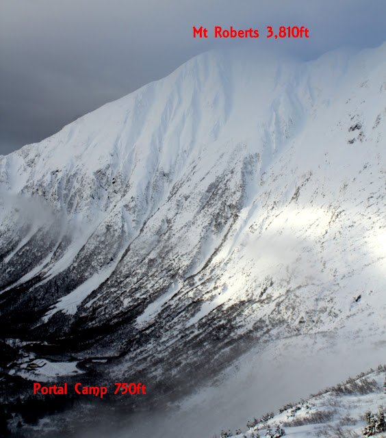
Top 1500ft of the 3,000ft lines off Mt Roberts

Same pic as above, showing entire line to trail.

Saturday, December 24, 2016

12-24-16 Dan Moller Cabin

Short tour up near the Dan Moller Cabin to scope storm weather skiing terrain again.  Plenty of meadow skipping opportunities.

Mt Troy from above Dan Moller cabin.  This line looks kind of lame in the pic, but it's actually pretty cool.  Plenty of lines through the alders, which will probably fill in soon anyway.  It has about 1500 vertical of good skiing here on the east face.  The north face on the other side has some big bowls.

Mini golf lines above the cabin.  These are about 700-800ft shots.  The more open shots have sled traffic.

Looking down canyon from just above the cabin.  The approach is up that canyon on a sled track.

Dan Moller cabin.


Mt Roberts (3810ft) on the left with 3500ft of skiing to the valley.  And Sheep Mtn (4,238ft) on the right with a bit more vertical to the valley.  Huge, skiable faces with pretty easy approaches.