 |
| Cropley Chute |
Tuesday, January 31, 2017
1-31-2017 Cropley Chute of Ben Stewart
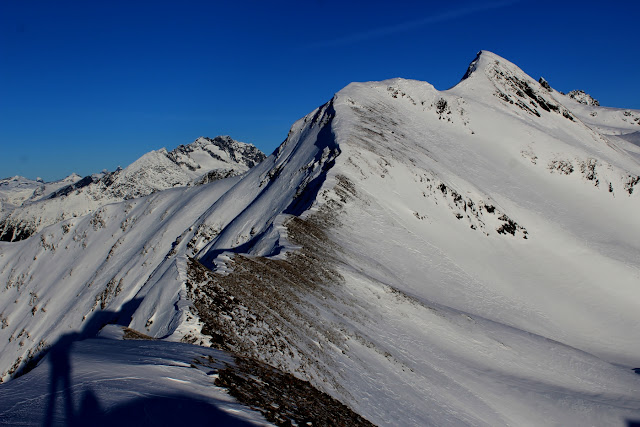
Skied the ultra classic Cropley Chute off of Ben Stewart by braille today. Clouded in, couldn't see more than maybe 5-10ft ahead, then it cleared and things got good. Dust on crust, but a fun line. Easy in, easy out.
1-25-2017 Eaglecrest Laps
Eaglecrest is closed some days mid-week. If it's storming, it's the perfect place to tour. Low avy hazard, easy access, and a warming hut at the top!
Monday, January 23, 2017
1-22-16 Gastineau Peak
Dawn patrol, no, make that a night patrol, up Gastineau Peak. Snowline was around 900ft to start skinning, but that's because the trees are so thick on the Mt Roberts trail. Snow was basically ice, with my ski crampons not penetrating the "snow". Pretty ridiculous, but skiable as long as it wasn't too steep. Here come the rains.........stuff is going to get trashed below 1000ft I'd imagine.
 |
| Mt Jumbo over Douglas and the Gastineau Channel |
 |
| Mt Juneau on the right. Most of those couloirs cliff out into ice climbs. |
 |
| Mt Juneau on the right, Douglas on the left. Looking down NW ridge of Mt Gastineau. |
Thursday, January 19, 2017
1-19-17 Kowee Creek
Shoulda stayed home. After all the rain and heavy snow, the skiing is terrible right now. Should improve after the next freeze coming up. Checked out a big bruiser of a wet slab avy up Kowee Creek. Broke on a roll-over, probably during the heavy rain event at around 1500ft. Ran about 500+ft with debris over 8ft deep. Unsurvivable, no doubt.
 |
| Crown size about 4ft. I'm guessing the heavy rains set up a glide crack/wet slab feature. |
 |
| Beta shot of ridgeline from Gastineau to Roberts. |
 |
| Mt Juneau on left with Mt Olds in the back of the canyon. Both great objectives in spring. |
 |
| Avy scouring a gully. |
 |
| Pleasant terrain above the Dan Moller hut. |
 |
| Mt Olds behind Juneau. |
1-17-17 Eaglecrest
1-15-17 Kowee Creek
Skinned up in pea soup and thrashed down through mashed potato snow. Too wet and creepy to do much else.
Tuesday, January 10, 2017
1-10-2017 Grandchilds Peak
Start at Montana Creek and skin about 1.5 miles of groomed nordic, then up a trail along the river. Leave the river and ascend through the woods to 2400ft on a trail (buried in winter). Then follow the ridge to Grandchilds Peak. From there, one could access the Mendenhall Glacier via a couple different routes.
 |
| Mt Stroller White on the left, Mt McGinnis on the right. McGinnis is a day tour. |
 |
| Stroller White on right, access to Mendenhall Glacier between Stroller and un-named rocky peak. |
 |
| Follow the red, then descend a thousand feet to the Mendenhall Glacier very near the Mendenhall Towers. |
 |
| Stroller White |
 |
| Flank of Grandchilds Peak and Lynn Canal. |
 |
| Final ridge to Grandchilds lower summit. |
 |
| Easy ridge up Grandchilds. |
 |
| Somewhat knife edge up to main summit of Grandchilds. Optional. Could ski into bowl on right and then up. |
 |
| See above caption. |
 |
| Steep terrain off of Grandchilds |
 |
| Grandchilds Peak from the trailhead. |
Sunday, January 8, 2017
1-8-17 Table Top Mtn
Stumbled around in the dark once again looking for a way up new (for me) terrain. Eventually gained the ridge, but with the last few days of 100mph winds, opted to essentially retrace my steps and stay off the steeper terrain.
 |
| Terrain behind downtown Juneau |
 |
| Ben Stewart on lookers right, Eaglecrest lookers left. |
 |
| Peak 5894 above Davies Creek, as viewed from Bridgett State Park |
 |
| Peak 4897 to the left of the previous peak. The other side of this is the Davies Creek Couloir. |
 |
| Chilkats, maybe 20 miles south of Haines. |
 |
| Same as above. |
 |
| Central Chilkats. |
Friday, January 6, 2017
Tuesday, January 3, 2017
1-2-17 Nugget Towers
Went up Nugget Valley/Nugget Creek to take a poke at looking at the base of the Nugget Towers to see if the two couloirs are skiable. It appears they are. Spring time could be a good time with a deeper snowpack, then find a nice cold night to freeze things in place, assuming the rockfall could be an issue. Might go back there again some day to check it out once more. Long, tedious walk, but good on a high danger day.
 |
| Nugget Towers with couloirs in question. |
 |
| Little shelter near the end of the trail, at about the 3.6 mile marker from the beginning. |
 |
| Mt Stroller white from Nugget Creek |
 |
| Mt McGinnis |
 |
| Stroller White above the Mendenhall lake and glacier. |
Subscribe to:
Comments (Atom)


